Over 100,000 people visit The Wrekin every year and evidence suggests at least three quarters of them are locals. Despite this, we still receive many enquiries about the hill and its vital statistics, and we’ve tried to replicate a selection below!
If you can’t find the answer you’re looking for, please feel free to get in touch via the contact page. If we don’t know the answer, we probably know someone who will! Of course, you could also head over to our downloads section and explore our trio of Explore the Wrekin guides.
How tall is The Wrekin? 1334 ft. While this is not tall enough to make it a mountain, or even the highest hill in Shropshire (that honour belongs to Brown Clee), with a drop of over 150 metres on all sides it does qualify for the prestigious status of ‘Marilyn’! This ironic nomenclature (a punning alternative on the Munro classification system) is synonymous with ‘hill-bagging’, and you can discover more about that particular pastime here.

The Wrekin: a 1334-foot Marilyn no less! (Gordon Dickins)
How old is The Wrekin? The Wrekin first surfaced during an intense period of geological upheaval between 542 and 635 million years ago, when a number of other famous Shropshire landmarks (including Caradoc, the Long Mynd and Lilleshall Hill) also emerged. However, it is not the oldest of the Wrekin range for that honour belongs to Little Hill, which is over 677 million years old and contains rocks that pre-date life on Earth itself.
Is The Wrekin a dormant volcano? While the formation of The Wrekin is the result of geological activity associated with volcanic events it is not a volcano. Broadly speaking, it consists of a thick, mile-wide pile of lava and ash that was once violently discharged from long dormant volcanic vents in the Earth’s surface. The geology of the Wrekin Forest is among the most complex to be found anywhere in Shropshire and to better understand the full picture we recommend a trip to the British Geological Survey website.
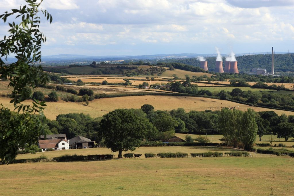
How many hills are there in the Wrekin Range? Five: The Wrekin, The Ercall, Little (or Primrose) Hill, Maddocks Hill and St Lawrence’s Hill.

Three From Five: St Lawrence’s Hill and The Wrekin from the summit of The Ercall (Gordon Dickins)
How many counties are visible from the top? Evidence suggests twenty historic counties of England and Wales are visible from The Wrekin on a clear day, including the summits of Blake Moor, Yorkshire (73 miles distant), Winter Hill, Lancashire (66 miles), Chastleton Hill, Oxfordshire (63 miles) and Pen Y Fan, Brecknockshire (66 miles). The full list is as follows:
Brecknockshire, Ceredigion, Cheshire, Denbighshire, Derbyshire, Flintshire, Gloucestershire, Lancashire, Herefordshire, Leicestershire, Merionethshire, Montgomeryshire, Monmouthshire, Oxfordshire, Radnorshire, Shropshire, Staffordshire, Warwickshire, Worcestershire, Yorkshire.
Can I see Snowdon? The idea that Snowdon, 120 miles northwest, is visible from The Wrekin appears to have been given credence by the Wellington-born Victorian novelist Hesba Stretton who made the assertion in her novel Alone In London. While highly informative, the toposcope on the hill formally enshrines the claim but, sadly, Snowdon is not visible from The Wrekin, nor The Wrekin from Snowdon — the two being obscured from each other by Cadair Berwyn (which is a mere 38 miles distant from the Shropshire summit).
Can I drive to the top of The Wrekin? While there are a number of serviceable tracks to the top and around the perimeter of the hill (well, serviceable to a 4×4 that is!) you will need the permission of the relevant landowner to use them. For the northern half of The Wrekin, that is the Orleton Estate and for the southern half the Raby Estate.
Is the Rifle Range still active? No. Despite the presence of several large and very prohibitive signs to the contrary, the rifle range (which lies between the Wrekin Course road and northwest edge of the hill) has not been used since at least 1980. However, the site itself remains largely in situ and it’s well worth a walk around the side of the hill to view its remains.

On the Needle’s Eye looking south towards the Severn Valley (Gordon Dickins)
What is the Needle’s Eye? The Needle’s Eye is perhaps the most famous of the rocky outcrops atop The Wrekin, probably because its distinctive profile incorporates a large cleft that many visitors choose to clamber through. Many myths and legends abound regarding this particular right of passage but the journey has been rendered even more hazardous by the 1990 earthquake, which closed the gap considerably. Nearby, the Raven’s Bowl (or Cuckoo’s Cup) is another outcrop with strong folkloric credentials that requires an equally fraught journey to view the tiny, water-filled depression from which it takes its name (its located right at the summit of the rock).
Far easier to visit, and much less widely known, the calendar stones lie on a plateau beneath their two famous neighbours and, provided it is sunny, mark the passage of time each equinox (courtesy of a refracted, coin-sized shaft of light that creeps across the bottom of one of the rocks just after midday). Follow this link for a fuller explanation courtesy of the venerable George Evans.
When was the transmitter erected? The 171 ft. Ultra High Frequency (UHF) TV and radio transmitter on top of The Wrekin was opened by the BBC in 1975 and is the main station for Shropshire and the Marches. Click here for more background on the facility and the decade–long search to find a suitable site for broadcasting to the region and beyond.

The BBC transmitter first opened in 1975 (Gordon Dickins)
Where is the Wrekin Beacon? The modern day beacon is a blinking red light situated on the transmitter mast but this wasn’t always the case. Search the Old Top (which lies northwest of the topograph and trig point) and you’ll soon come across the concrete foundations of the former incumbent, which was finally switched off in 1970. Evidence suggests the top of hill has served as a fiery outlier since at least Tudor times, and its role was famously reprised in Lord Macaulay’s stirring 19th Century ode to the defeat of the Spanish Armada, in which he elegantly described as ‘streamed on the wind, The Wrekin’s crest of light’ when forewarning of the flotilla’s arrival.
For more information about The Wrekin Beacon and the other manmade structures atop the hill, click here for an in-depth article by Anth Rowley.
Who were the Cornovii? The Cornovii were a Celtic tribe that controlled a large, pre-Roman kingdom that stretched from the Wirral to the borders of modern day south Shropshire. The Wrekin was its principal hillfort and the well-preserved remains of a structure that was begun around 1000 BC encircle the top of the landmark to this day. The most apparent features of this Scheduled Ancient Monument are probably its inner and outer entrances (Hell Gate and Heaven Gate), which continue to permit access to the summit for visitors travelling along the main track to the hill.

The Wrekin Hillfort is a Scheduled Ancient Monument – Please don’t climb on the ramparts! (Gordon Dickins)
Was The Wrekin invaded by the Romans? Despite the appearance of several local signs to the contrary, there is, save for an excavated javelin head, no evidence the Romans stormed the hill when they arrived in the area in the spring of 47AD. Whatever the course of history actually was, what we do know is that the Cornovii eventually relocated to the Roman camp-cum-town at Virocnium-Cornoviorum (Viroconium of the Cornovii), where they remained until around 500 AD, when the settlement, which had long since been vacated by the Romans, was destroyed by fire.
How large is the Wrekin Forest: at its greatest extent, the medieval Royal Forest of Mount Gilbert (for The Wrekin was renamed by the Normans, reputedly in honour of a local hermit) extended for over 120 square miles from the outskirts of Shrewsbury to Sheriffhales. However, much of the territory encompassed large areas with no forest cover at all and was effectively included in order to allow the Crown to raise money in an era before taxation. Although it lacks a definitive boundary, the modern day equivalent is based on a management plan devised by Shropshire Wildlife Trust and extends southwards from the edge of Wellington to the River Severn at Buildwas.
The Wrekin Forest once extended over an area of 120 square miles (Gordon Dickins)
Deer culling: deer have been part of the local forest landscape for at least a thousand years (depending on whether you believe they were introduced by the Romans or the Normans). The southern half of the hill is still commercially forested by the Raby Estate and the browsing activity of deer can be potentially damaging to young trees. For that reason, the population is controlled by the landowner.
Where has the Forest Glen Pavilion gone? Between 1889 and 1993, the Forest Glen pavilion served generations of famished Wrekin visitors with ‘teas and luncheons’. After its closure, the pavilion was removed to Blists Hill museum at Coalport, where it has since been erected (hands up if you’d like it back!). The site is now maintained by Shropshire Wildlife Trust (which also manages The Ercall and Limekiln Wood Local Nature Reserve, while refreshments are still available at the Halfway House on the main track up the hill.
So, where are the toilets? In short there aren’t any! The local ‘facilities’ opposite the Forest Glen car park were demolished by Telford and Wrekin Borough Council a number of years ago and not replaced. If you think the situation is unacceptable — and many do — why not address your complaints to the unitary authority.